The days are getting shorter, the air crisper, and trees are beginning to cast off their foliage with urgency. While all of these signs remind us that summer is gone and winter looms just over the horizon, it’s not time to go into hibernation just yet. There’s no better time than now, when the leaves are brilliant and the bugs are nowhere to be seen, to get out and discover some of the fantastic hiking options that the St. Cloud area has to offer.
While most have likely heard of some of the more popular hiking spots in St. Cloud, such as Quarry Park and Riverside Park, this guide contains a few lesser-known destinations for a last fling with your hiking shoes.
- Sand Prairie Wildlife Management Area
This 700-acre WMA is located on the Mississippi glacial flood plain and hosts an abundance of native grasslands and opportunities for wildlife viewing.
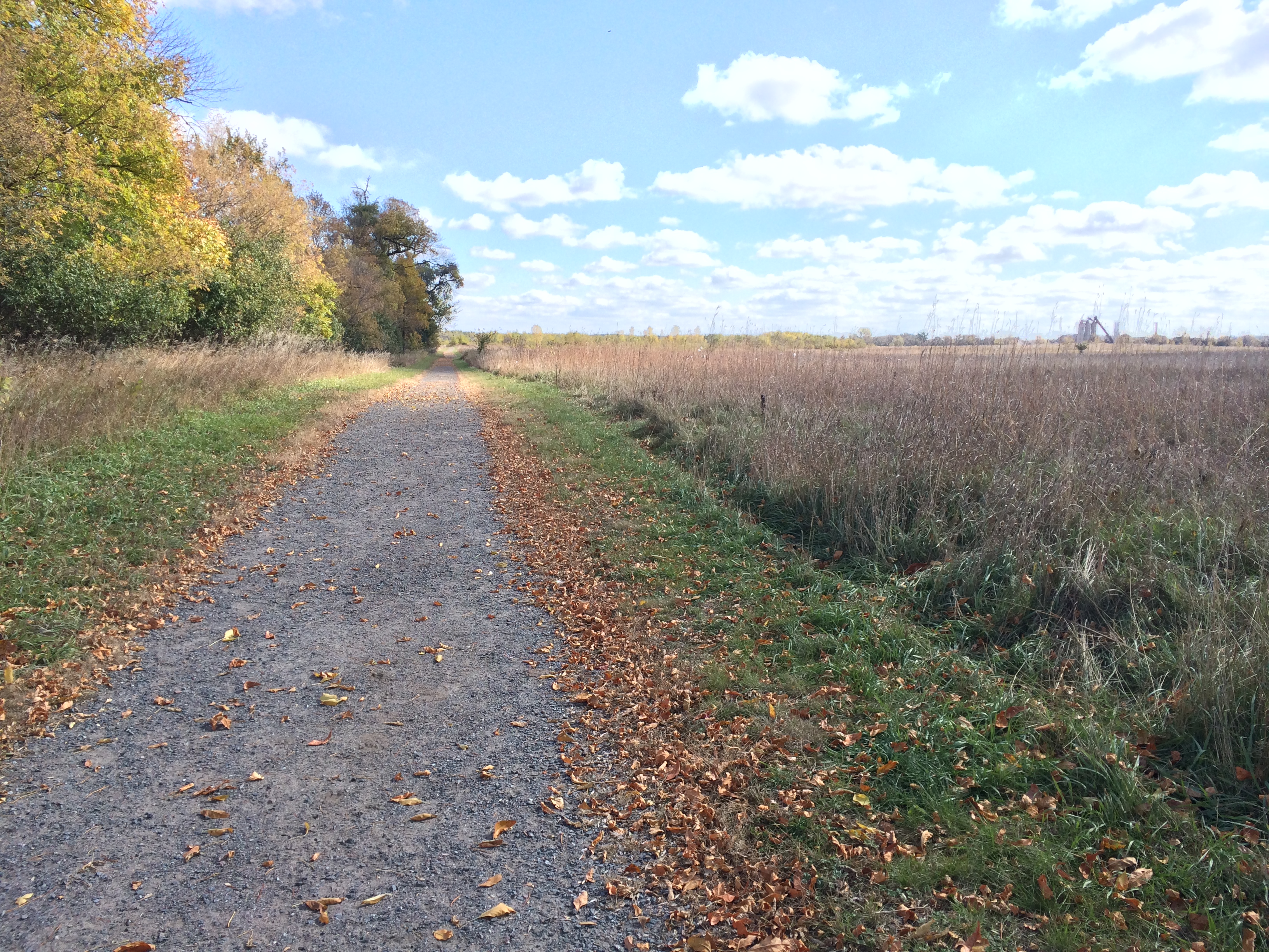
The first ½ mile is a wide gravel trail that offers up beautiful views of the waving prairie grasses. To the left of this gravel trail, there are several places where the trail diverts into a narrower, grassy trail that leads into the woods to the left.
If you continue on the grav el trail, you will eventually come to a wooden sign that says “Observation Deck” that, if you follow, will point you down a wooden boardwalk that cuts through a marsh. Once past the boardwalk, follow the trail straight for a few steps and you will see a large observation deck to the northeast, which overlooks a wetland- usually filled with various species of birds.
From here, you can either follow a trail east that will take you through more wide open grasslands, or take a trail west that will take you through a tract of deciduous woods.
Directions: From SCSU, go east over the river on University Drive SE. Take a left onto Kilian Boulevard SE, then follow the curve until the road turns into Minnesota Boulevard. Go straight until the road runs into Highway 10. Go straight across Hwy 10 and then immediately take a left onto the dirt frontage road. The dead end at the end of the dirt road is the parking lot for Sand Prairie WMA.
- River Bluffs Regional Park
Distance from SCSU: 4.5 miles
This is a relatively short trail with an impressive variety of ecosystems for its size. On the hike you will experience deciduous woods, grassland and river.
On the north end of the parking lot, there is a small yellow trail sign pointing to the start of the narrow dirt trail. This trail hugs the top of a ridge overlooking a prairie to the east.
There are two exit points from this main path that will lead you down to the meadow below. The first is about a half-mile from the trailhead to the right and will lead you down to and around the south side of the meadow. The second is a little further up the main path and also to the right. This path carves steeply down the side of the hill and cuts sharply to the left once you get to the meadow and turns into little more than a deer trail. There is actually a good chance of spotting some deer in this meadow.
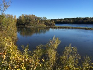
Either path will lead you to the Mississippi River. Once you get to the Mississippe, you can turn north and hike for a half-mile before you hit a dead end. If you go south, you will come to a parking lot and boat landing. On the south side of the boat landing, there is a yellow trail marker pointing you to more trails, which meander through woods and contain several lookout points with sweeping views of the river.
Directions from SCSU: Go south on Clearwater Road until you get to Roosevelt Road. Take a left on Roosevelt and turn about a mile down onto 40th Street South. At the stop sign, take a left onto Clearwater Road. River Bluffs Regional Park will be at the end of this road.
- Ski trails off of Minnesota Boulevard
Distance from SCSU: 1.3 miles
Many people are familiar with Graystone park, the ski trails across from the prison, but fewer have probably heard of the unnamed trails just west of Graystone on Minnesota Boulevard. As it is not allowed to hike Graystone from April-November, this offers an even closer alternative for the Summer/Fall months.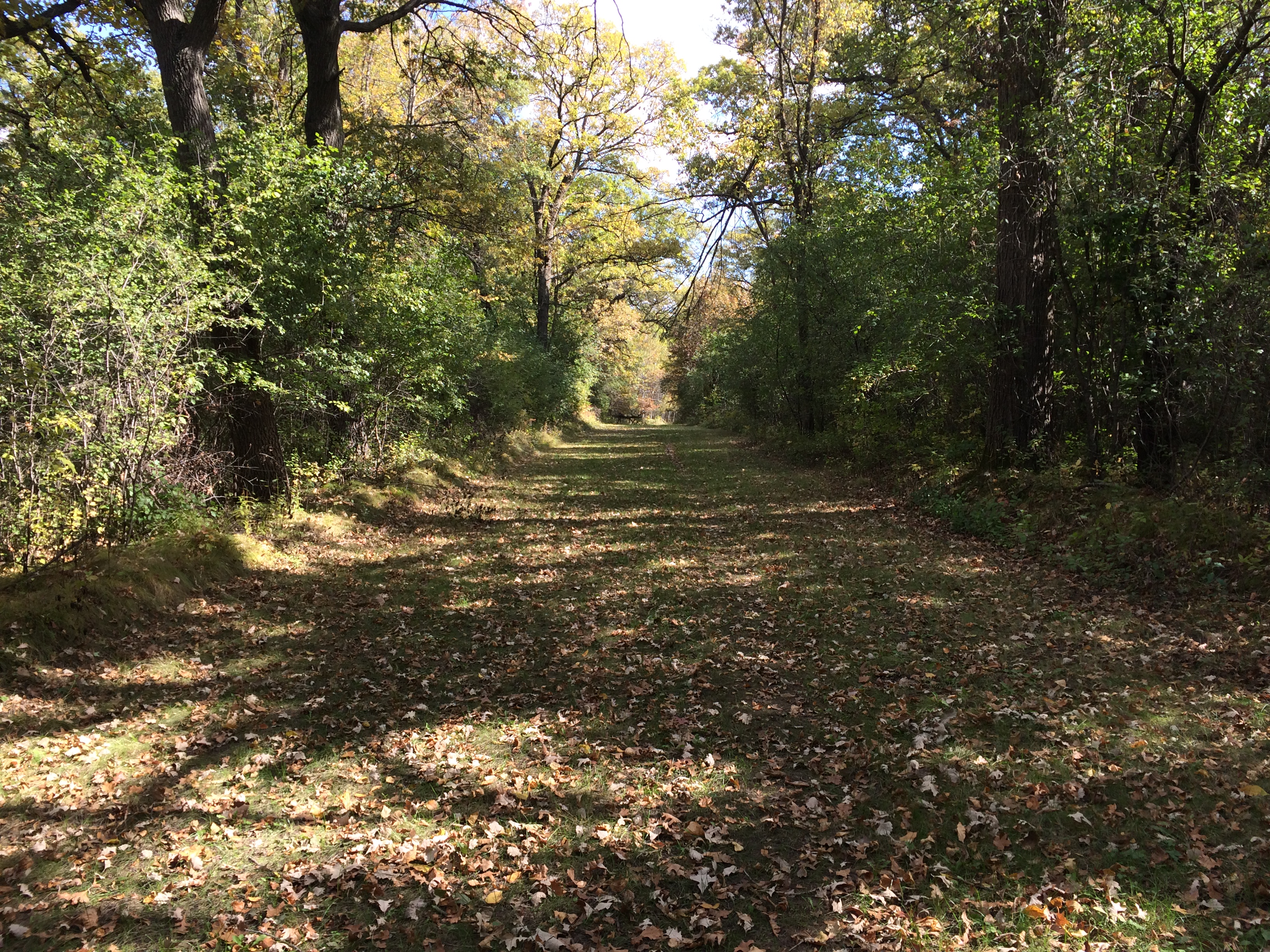
This public space is on the corner of Minnesota Boulevard and 15th Avenue SE. The entry point for vehicles is on Minnesota Blvd., across the street from St. Benedict’s Care Center.
The area contains a few miles of wide, grassy trails, interwoven with narrow dirt paths set in a primarily deciduous wooded area.
Directions from SCSU: Follow University Drive SE east until you hit 15th Avenue SE, and take a right. Take a left on Minnesota Boulevard and there will be a dirt road leading to the park on the left.
4. Saint John’s Arboretum
Distance from SCSU: 11.6 miles
 This is the furthest of the four destinations in this guide, but definitely worth the trek if you have a vehicle or can catch a ride with a friend. Located in Collegeville, Minnesota, Saint John’s Arboretum encompasses over 2,500 acres of lakes, prairie, oak savannah and forest settled by Benedictine monks in 1864. The arboretum contains many miles of secluded, rolling trails, including several boardwalks crossing over marshes.
You can find a map of the extensive trail system at www.csbsju.edu/outdooru.
Quick tip: Don’t forget to check out the twig house at the entrance of the Boardwalk Loop.
Directions from SCSU: Head west on University Drive S until you get to Cooper Avenue South; take a right. Turn left onto West Division Street. Continue straight for several miles until Division turns intoHighway 75. Continue straight, driving through St. Joseph, until Hwy 75 merges with Interstate 94. In about 1.5 miles, take the St. John’s University exit. After exiting, take a left onto Collegeville Road. This road will take you straight onto the St. John’s University campus.
